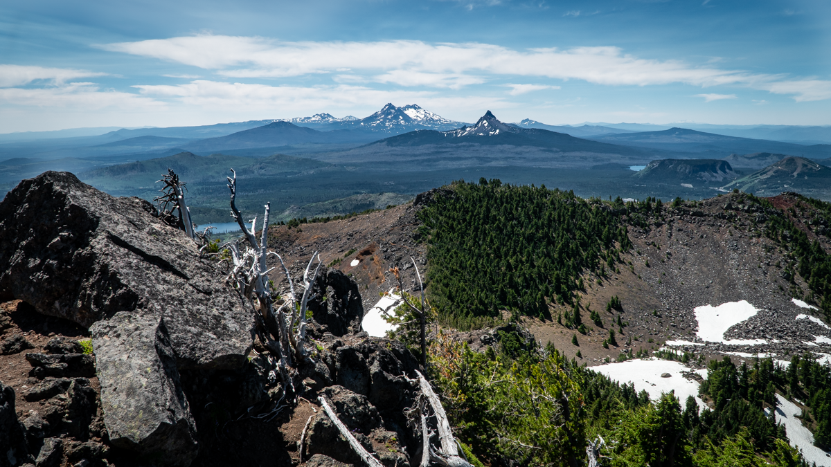
We have hiked to Three Finger Jack's base several times through the NE access to it from Jack Lake via Canyon Meadow in the Mount Jefferson Wilderness. Last Saturday, July 3, 2021, we decided to hike to Three Finger Jack from the South from Santiam Pass along the Pacific Crest Trail (PCT). The route from Santiam Pass takes hikers through part of the 90,000 acres which burned in the 2003 B&B complex fire. 18 years later, the area still has many burned trees, but new growth is abundant with wildflowers, young trees and mosquitos. And the views toward Mt. Washington and the Three Sisters are evident through the burned trees, many of which have fallen across the trail and need to be either walked around or stepped over.
We had planned on hiking 5 miles in to what was described as a "viewpoint" in one of our hiking books. This hike would be roughly 10 miles round trip with 1500 feet elevation gain. However, as we proceeded along the hike and left the burn scars and entered areas of old growth forest, it became obvious that the trail app we were following was different than that which we read about in our local hiking book. The app led us to a "viewpoint" which was located just below the South Pillar of Three Finger Jack. As we climbed toward this extremely difficult location, we were half way before we recognized we had taken a wrong turn, but since we were half way, we became determined to complete the trek. The rewarding views were worth the difficulty, mosquito bites, and sore muscles. Plus we accomplished a "bucket list" item which we never had in the bucket to begin with. According to our app, we actually covered over 2300 feet of elevation gain and 12 miles round trip. We would not recommend this mistake to many, having determined that this unofficial trail is what is used by those few who rock climb the mountain, most of whom are much younger than us.