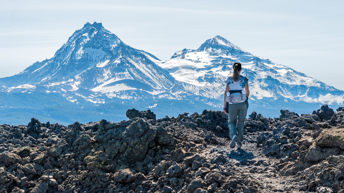
We enjoy hiking the various trails accessed via McKenzie Pass (Hwy 242) while it is open during the warmer months. One trail we attempted the first time a year ago but didn't complete due to freezing temperatures was Belknap Crater. The trailhead is located just past the Observatory and traverses a section of the Pacific Crest Trail (PCT). The unique topography of this hike passes through two wooded "islands" which survived the recent (last 1000 years) volcanic eruption of Little Belknap Crater and provide for shade in this otherwise exposed terrain. Past the last island, the hike climbs onto twisted, rugged lava complete with lava bombs, pressure ridges, lava tubes, and of course, the two peaks which were the origin of the miles of lava the hike takes trekkers through. Good footwear is essential as is a good hat in this exposed landscape and we do not recommend dogs due to the rough ground which can cut their paws. We delayed this hike until it was cooler in order to avoid the high temperatures which a sunny summer day can generate on the exposed black and red rock.
The hike is not too difficult with 1100 feet of elevation gain to reach the top of Little Belknap Crater in roughly 2.6 miles. But once we enjoyed the views from the top of Little Belknap, we elected to continue on past the lava fields and tackle the steep hike up Belknap Crater. This additional trek averages a 17% grade with a maximum grade of 49% in under a mile and a total of 737 feet in additional elevation. Belknap Crater does not have the rough lava surface of Little Belknap, but rather a smoother pumice and dirt surface with its older topography supporting plants and trees. We enjoyed the views before returning the way we had come. All in all, this hike was less than 8 miles round trip, but did provide for fabulous views of Mt. Washington, North and Middle Sister, and The Husband.