Chush Falls is Snow Free and Ready for Hikers
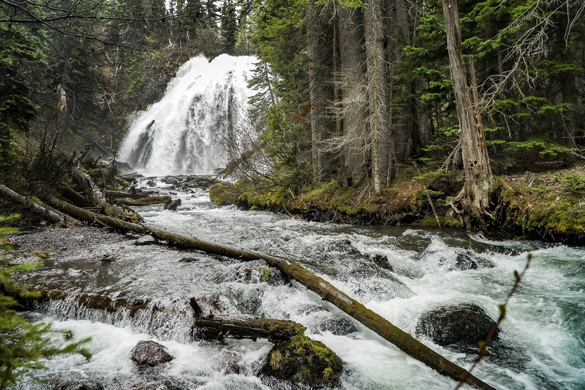
We have hiked Chush Falls several times, usually during the fall or winter with snow and ice. However, this Memorial Day weekend we elected to take the hike in the Three Sisters National Wilderness snow free. Unlike earlier hikes, many of the recently downed trees from the 2017 Milli Fire had been cut which enabled us to more easily hike the first two miles. However, the last quarter to half mile to the viewpoint had yet to receive this attention and scrambling over and under downed trees can always create challenges. The viewpoint overlooking Chush Falls is fairly obstructed by trees, so we typically take the very steep path down to the base of the falls, a path which should only be taken by people who are fit enough to make it both down and up. We had never seen the 60 foot Chush Falls as full as it was with the snow runoff from our wet winter really impacting the rivers and streams. Unlike winter time, if we got close to the falls, we would have been quite wet so we stayed a bit back and enjoyed the view from a distance.
After clambering back up to the viewpoint, we decided to extend the hike to Upper Chush Falls, having never gone past Lower Chush Falls during our previous winter hikes. No attempt had been made to clear any downed trees, so hiking with GPS was very helpful since we often had to leave the path to maneuver around large fallen trees. It wasn't far past Lower Chush Falls that we reached the first lovely waterfall, the Cascades. Located on Whychus Creek just above the confluence with Park Creek, the Cascades is viewable just from the trail, without an easy way to get closer. Continuing past the Cascades, within a half mile we were surprised to see the spectacular, 200 foot Upper Chush Falls. For those of us familiar with Central Oregon waterfalls, Bend's popular Tumalo Falls is 97 feet. We didn't expect to see such a beautiful, towering waterfall. Following a social trail, we attempted to find a great viewpoint, but ended up on a steep ledge which felt a bit perilous, so we backtracked down to the base of the falls, getting as close as the vegetation would allow. All in all, we were very happy with our decision to hike the extra distance to experience all 3 waterfalls. Per GPS, we traveled a total of 6.25 miles with 950 feet of elevation gain (more than most trails note due to our steep side trips).