The "Unofficial" Hiking Route on Lower Whychus Creek
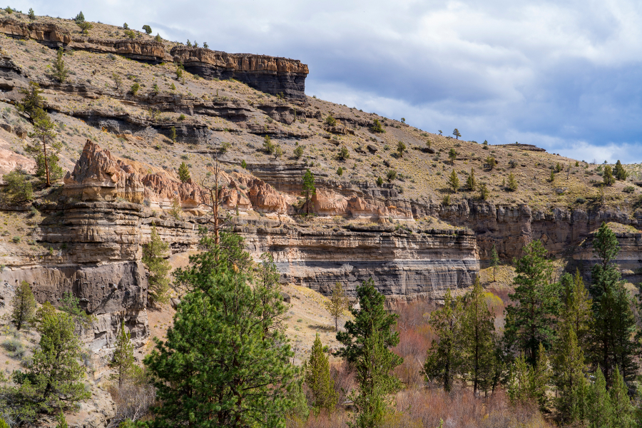
We hiked to Alder Springs last year for the first time. This lovely canyon oasis, located on Whychus Creek near the confluence of the Deschutes River, has beautiful geological formations and stunning sights at every turn. The "official" and "unofficial" trails are closed December 1 through March 31, but during our recent hike April 24th, 2021, we saw fewer than 20 people the entire time and no one at all on our "unofficial" trail. The unofficial trail starts at Whychus Creek Crossing, located inside the Crooked River National Grassland. The road to the crossing is rough, passable by standard car, but we would recommend a 4 wheel vehicle. There are several picnic tables at the crossing and no trailhead. But if you walk past the last picnic table, keeping Whychus Creek on your right, you will eventually find a trek that takes you down the creek 3.5 miles until you reach Alder Springs. The hike takes you up and down a bit on the escarpment bordering Whychus Canyon and in places is a bit sketchy near steep drop offs into the canyon. But the trail, although faint, is very passable and once you get close to Alder Springs, the trail will drop into the canyon bottom next to the ford over the creek.
Past the spring, hikers can walk another 1.5 miles to the confluence of Whychus Creek with the Deschutes River. This little additional trek was absolutely wonderful and is an experience not to miss. The rivers were full, but the foliage just starting to leaf out, so the views of the river from the trail were fairly visible and creek access doable. We believe later in the year, once the foliage is full and growing, river access may be harder to obtain. One of these side treks from the hike provided a beautiful view of a "weeping wall" - water flowing from the canyon wall into Whychus Creek which reminded us of Hawaii.
The confluence of Whychus Creek with the Deschutes was absolutely stunning with both waterways full from snowmelt. The rock outcropping at the end of the trail was a great place to have lunch, take pictures, and enjoy the beauty of Central Oregon.
After lunch, our hike back to Whychus Crossing was fairly uneventful, with the exception of the snake stretched out on our trail (we walked around it). During the summer the area will get very warm with the only shade near the creek. But early spring and late fall, the 10 mile round trip hike is a great way to spend a day enjoying Central Oregon's high desert.
To find Whychus Creek crossing and our "secret" hike to Alder Springs, take Locust Street (Camp Polk Road) in Sisters 3.1 miles north from East Cascade Avenue. Take this to Wilt Road, staying on Wilt when the pavement ends 4 miles. Past Rimrock Ranch, the road is less maintained. Travel another 2.5 miles until you see a sharp unmarked turnoff to the right on the rough road we mentioned earlier. This turnoff has a brown sign noting the area being closed December 1 through March 31. Travel on this until you reach the crossing.